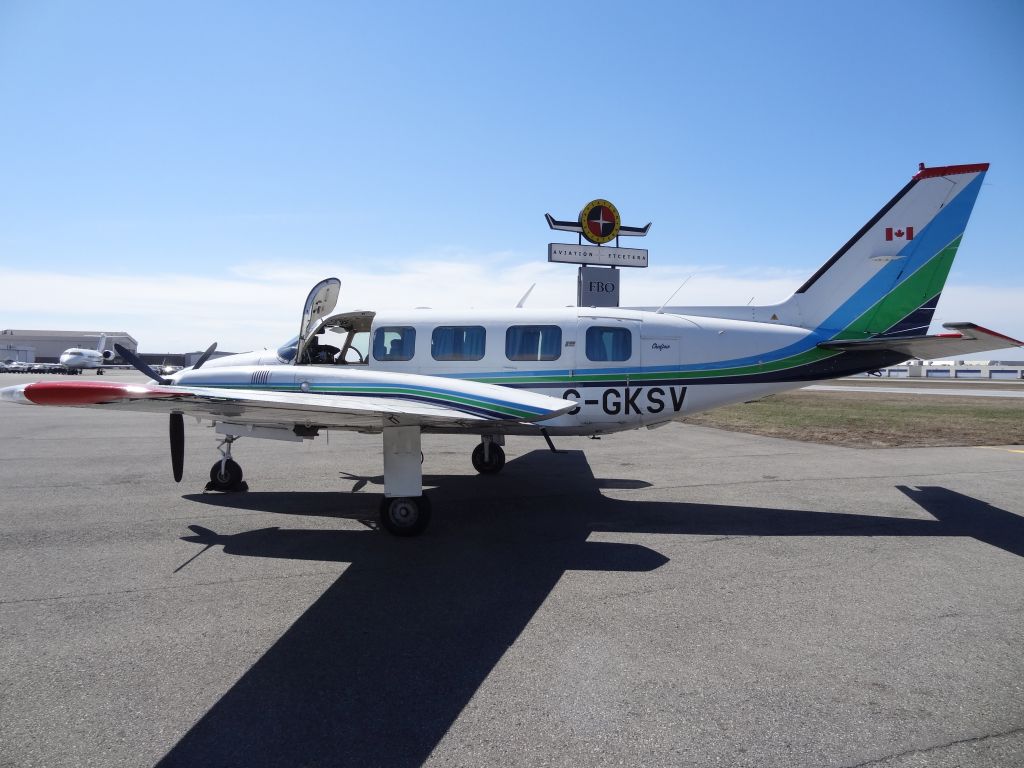
Antigua and Barbuda is benefitting from aerial Light Detection and Ranging
(LiDAR) surveys jointly sponsored by the Caribbean Development Bank (CDB)
that are designed to enhance the country’s physical planning process.
These surveys are being conducted in collaboration with the Caribbean
Community Climate Change Center (CCCCC), which has acquired a LiDAR
sensor under a United States Agency for International Development (USAID)
project, and is seeking to sensitize the region about its use and efficacy for, inter
alia, development planning purposes.
The areas to be surveyed include the entire landmass of Antigua (is Barbuda
included?) and the marine sections of the northeast area, Willoughby Bay, and the
Nelson’s Dockyard National Park. The aerial surveys commenced this week and
run for approximately one week in May and another week in early June.
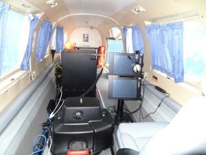
The LiDAR program intends to provide high resolution geo-spatial data needed for
sustainable development planning, land use planning, building climate change
resilience, and improving disaster preparedness to face the existential threat of
climate change.
This venture was made possible by the CCCCC through funding by the CDB and
USAID; the Department of Environment through funding from the Green Climate
Fund (GCF); and the National Parks Authority providing counterpart funding
through the Marine Ecosystems and Protected Area (MEPA) Trust funded by the
Caribbean Biodiversity Fund (CBF).
Antigua and Barbuda expresses its gratitude to the CCCCC, CDB, USAID, GCF,
MEPA Trust, and the CBF for providing this opportunity to the country.
